

 |
Multi Constellation GNSS Integrated Navigation System MIL-STD-810G For Commercial Applications
Product Details:
| Place of Origin: | China |
| Brand Name: | BTSTC |
| Certification: | CE |
| Model Number: | INS70S |
Payment & Shipping Terms:
| Minimum Order Quantity: | 1 |
|---|---|
| Price: | Negotiable |
| Packaging Details: | box and sponge |
| Delivery Time: | 7 days for sample |
| Payment Terms: | T/T |
| Supply Ability: | 1000/month |
|
Detail Information |
|||
| Certifications: | MIL-STD-810G, RTCA DO-160G | Mtbf: | 10000 Hours |
|---|---|---|---|
| Compatibility: | Military And Commercial Applications | Speed Accuracy: | <0.15m / S (RMS) |
| Power Supply: | Rechargeable Battery | Attitude Angle Error: | ≤2° |
| Sensors: | Accelerometer, Gyroscope, Magnetometer | Positioning: | Multi Constellation GNSS |
| Highlight: | Integrated Navigation System MIL-STD-810G,Multi constellation GNSS Integrated Navigation System,Commercial Applications Navigation System |
||
Product Description
Product Description:
The Integrated Navigation System is a state-of-the-art solution for applications that require robust and accurate navigation data. This system is designed to meet the stringent requirements of military, aerospace, and commercial sectors, providing reliable performance in the most challenging environments. The Integrated Navigation System is an amalgamation of advanced technology that includes High Precision MEMS Integrated Navigation System and High Precision FOG Integrated Navigation System components, ensuring that users have access to precise positioning, navigation, and timing (PNT) information at all times.
One of the key product attributes of the Integrated Navigation System is its adherence to rigorous standards. With certifications including MIL-STD-810G and RTCA DO-160G, this system is built to withstand harsh conditions such as shock, vibration, temperature extremes, and other environmental factors that are commonly encountered in field operations. These certifications are a testament to the durability and reliability of the Integrated Navigation System, making it an ideal choice for deployment in critical applications.
At the heart of the Integrated Navigation System is its positioning accuracy. Boasting a Position Accuracy of 5m (RMS), the system ensures that users are provided with precise location data. This level of accuracy is crucial for various applications such as navigation of unmanned vehicles, target acquisition, and asset tracking. By integrating High Precision MEMS Integrated Navigation System technologies, the system is capable of maintaining this accuracy even when GNSS signals are unavailable or compromised.
In addition to position accuracy, the Integrated Navigation System also excels in Speed Accuracy, with a remarkable specification of less than 0.15m/s (RMS). This feature is particularly important for applications that require precise velocity measurements such as guidance and control of vehicles, as well as for surveying and mapping operations where both positional and speed accuracy play a crucial role.
Positioning is handled by a Multi-constellation GNSS receiver, which allows the Integrated Navigation System to leverage multiple satellite systems, such as GPS, GLONASS, Beidou, and Galileo. This multi-constellation approach ensures continuous and reliable PNT information, as the system can switch between constellations or use them simultaneously for enhanced accuracy and redundancy. The integration of High Precision FOG Integrated Navigation System components further augments the system’s capability to provide accurate information regardless of external challenges.
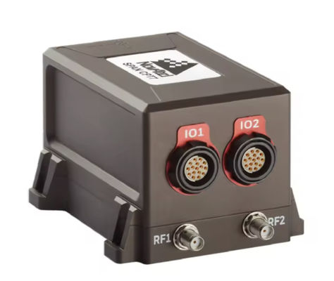
The Integrated Navigation System is equipped with a suite of sensors that contribute to its superior performance. These include an Accelerometer, Gyroscope, and Magnetometer, all of which are integral to the system's ability to deliver comprehensive navigation solutions. The Accelerometer measures acceleration forces, allowing for precise movement tracking and orientation. The Gyroscope provides vital information on the system's rotation and angular velocity, which is essential for maintaining correct heading and attitude. The Magnetometer, acting as a digital compass, assists in determining the system’s orientation relative to the Earth's magnetic field.
The fusion of these sensors, along with advanced algorithms, result in a robust and reliable Integrated Navigation System. By utilizing both High Precision MEMS and FOG technologies, the system delivers unparalleled performance in PNT data provision. Whether for military operations, autonomous vehicle navigation, or high-stakes commercial activities, the Integrated Navigation System is engineered to provide users with the confidence that comes from having accurate and dependable navigation information at all times.
In summary, the Integrated Navigation System is a comprehensive solution that offers unmatched accuracy, resilience, and versatility. It is a prime example of innovation in navigation technology, combining High Precision MEMS and FOG systems to meet the demands of modern navigation challenges. With its rigorous certifications, exceptional position and speed accuracy, multi-constellation GNSS support, and array of high-quality sensors, this Integrated Navigation System stands out as a superior choice for any application where navigation precision is paramount.
Features:
- Product Name: Integrated Navigation System
- Weight: Less Than 1kg
- Speed Accuracy: <0.15m / s (RMS)
- Compatibility: Military And Commercial Applications
- Accuracy: 0.01 Degrees
- Application: Tactical Weapons
- Key Feature: High Precision FOG Integrated Navigation System
- Key Feature: High Precision MEMS Integrated Navigation System
- System Type: Integrated Navigation System
Technical Parameters:
| Parameter | Specification |
|---|---|
| Sensors | Accelerometer, Gyroscope, Magnetometer |
| Attitude Angle Error | ≤2° |
| Power Supply | Rechargeable Battery |
| Mtbf | 10000 Hours |
| Size | Compact |
| Application | Tactical Weapons |
| Speed Accuracy | <0.15m / S (RMS) |
| Compatibility | Military And Commercial Applications |
| Weight | Less Than 1kg |
| Position Accuracy | 5m (RMS) |
Applications:
The BTSTC INS70S Integrated Navigation System is a state-of-the-art solution designed for a variety of applications where accurate navigation and positioning are critical. As a cost-effective integrated navigation system, the INS70S offers an ideal balance between performance and price, making it accessible for a wide range of users requiring high precision navigation support. Manufactured in China with a robust certification of CE, the BTSTC INS70S is a testament to quality and reliability.
This model, with its compact size, is perfect for scenarios where space is at a premium but performance cannot be compromised. Given the high precision FOG (Fiber Optic Gyro) technology underpinning the INS70S, it boasts an attitude angle error of ≤2°, ensuring accurate readings in even the most demanding situations. This makes it suitable for applications in aviation, marine navigation, land surveying, and unmanned vehicle guidance, among others.
The INS70S is designed to be as user-friendly as possible, with a minimum order quantity of just one unit and a negotiable price point. Its packaging details – a box with sponge for added protection during shipping – reflect BTSTC’s commitment to delivering their product safely and securely. With a delivery time of just 7 days for a sample and payment terms that include T/T, acquiring this high precision FOG integrated navigation system is both efficient and straightforward.
BTSTC's supply ability of 1000 units per month ensures that even large scale deployments are possible. The INS70S comes equipped with a rechargeable battery, making it a versatile tool for field operations where power access may be limited. The inclusion of multiple sensors such as an accelerometer, gyroscope, and magnetometer further enhances the system's capabilities, providing comprehensive navigational data in real-time.
The durability and resilience of the INS70S are evidenced by its adherence to the MIL-STD-810G and RTCA DO-160G certifications, which signify that the product can withstand tough environmental conditions, ensuring reliability in a wide range of operational scenarios. From the busy ports managing cargo shipments to the remote areas where geological survey teams rely on precise location data, the BTSTC INS70S is engineered to meet the diverse needs of its users.
In conclusion, the BTSTC INS70S represents a versatile, cost-effective solution for professionals across industries. Whether it's for commercial, research, or defense applications, this compact, high precision FOG integrated navigation system stands ready to deliver superior performance and reliability, underscored by its approachable cost and robust supply capability.
Customization:
Brand Name: BTSTC
Model Number: INS70S
Place of Origin: China
Certification: CE
Minimum Order Quantity: 1
Price: Negotiable
Packaging Details: box and sponge
Delivery Time: 7 days for sample
Payment Terms: T/T
Supply Ability: 1000/month
Application: Tactical Weapons
Certifications: MIL-STD-810G, RTCA DO-160G
Mounting: Surface Mount
Speed Accuracy: <0.15m / S (RMS)
Sensors: Accelerometer, Gyroscope, Magnetometer
Introducing the High Precision MEMS Integrated Navigation System by BTSTC, model INS70S, designed to deliver reliable and accurate positioning for tactical weapons. This cost-effective Integrated Navigation System is engineered with top-notch sensors including Accelerometer, Gyroscope, and Magnetometer, ensuring a speed accuracy of less than 0.15m / S (RMS). The INS70S, originating from China and meeting global standards with CE and additional certifications like MIL-STD-810G and RTCA DO-160G, is tailored for high-stake applications where precision is paramount. Choose BTSTC's INS70S for a High Precision MEMS Integrated Navigation System that combines performance with affordability.
Support and Services:
The Integrated Navigation System offers a comprehensive suite of technical support and services designed to ensure optimal performance and reliability. Our support includes access to a wide range of resources, including software updates, hardware maintenance, troubleshooting, and user training.
For software-related inquiries, our technical support team provides guidance on system updates, configuration issues, and feature enhancements to ensure your navigation system operates with the latest advancements and security measures.
When it comes to hardware, we offer maintenance services to help prevent potential issues and address any hardware malfunctions. Our team can assist with diagnostic procedures, replacement of components, and general upkeep advice to keep your system running smoothly.
If you encounter any operational difficulties, our troubleshooting support is here to help. Our experts are skilled in diagnosing and resolving a wide array of issues, ensuring minimum downtime and restoring functionality as quickly as possible.
To maximize the value of your Integrated Navigation System, we also provide user training services. These sessions are designed to enhance your understanding of the system's capabilities, improve operational efficiency, and ensure that you are fully equipped to handle the system's features and functions.
Our commitment to excellence in technical support and services is unwavering, and we strive to provide our customers with the assistance and resources they need to achieve seamless navigation experiences.
Packing and Shipping:
The Integrated Navigation System is encased in a sturdy, shock-resistant packaging material to ensure the product's integrity during shipping. The packaging is designed to withstand vibrations, drops, and impacts that may occur during transit.
Before sealing, each package is inspected to ensure that the Integrated Navigation System and all accompanying components are securely placed inside. The package includes a layer of static-free cushioning to protect the sensitive electronic components from electrostatic discharges.
The exterior of the packaging is clearly labeled with handling instructions and fragile warnings to alert carriers of the need for careful handling. Barcodes and tracking labels are also affixed to the outside for efficient logistics management.
Upon dispatch, the product is shipped through a trusted courier to provide real-time tracking and ensure timely delivery to the destination. The Integrated Navigation System is shipped with insurance coverage to protect against loss or damage during transport.
Upon receipt, recipients are advised to inspect the package for any signs of damage before accepting delivery. In the event of any discrepancies, customers should contact our customer service immediately to resolve the issue.
FAQ:
Q1: What is the brand and model number of the Integrated Navigation System?
A1: The brand is BTSTC, and the model number of the Integrated Navigation System is INS70S.
Q2: Where is the BTSTC INS70S Integrated Navigation System manufactured?
A2: The BTSTC INS70S is manufactured in China.
Q3: What certifications does the BTSTC INS70S Integrated Navigation System have?
A3: The BTSTC INS70S has the CE certification, ensuring it meets the European standards for health, safety, and environmental protection.
Q4: What is the minimum order quantity for the BTSTC INS70S, and how is it packaged?
A4: The minimum order quantity for the BTSTC INS70S is one unit. It comes packaged in a box with sponge for additional protection during shipping.
Q5: What are the delivery time and payment terms for purchasing the BTSTC INS70S Integrated Navigation System?
A5: The delivery time for a sample of the BTSTC INS70S is 7 days. Payment terms are T/T (Telegraphic Transfer), and the price is negotiable.
Q6: How many units of the BTSTC INS70S can be supplied in a month?
A6: The supply ability for the BTSTC INS70S Integrated Navigation System is 1000 units per month.