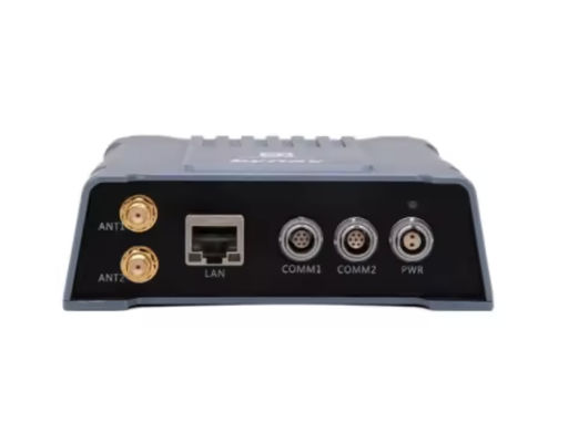
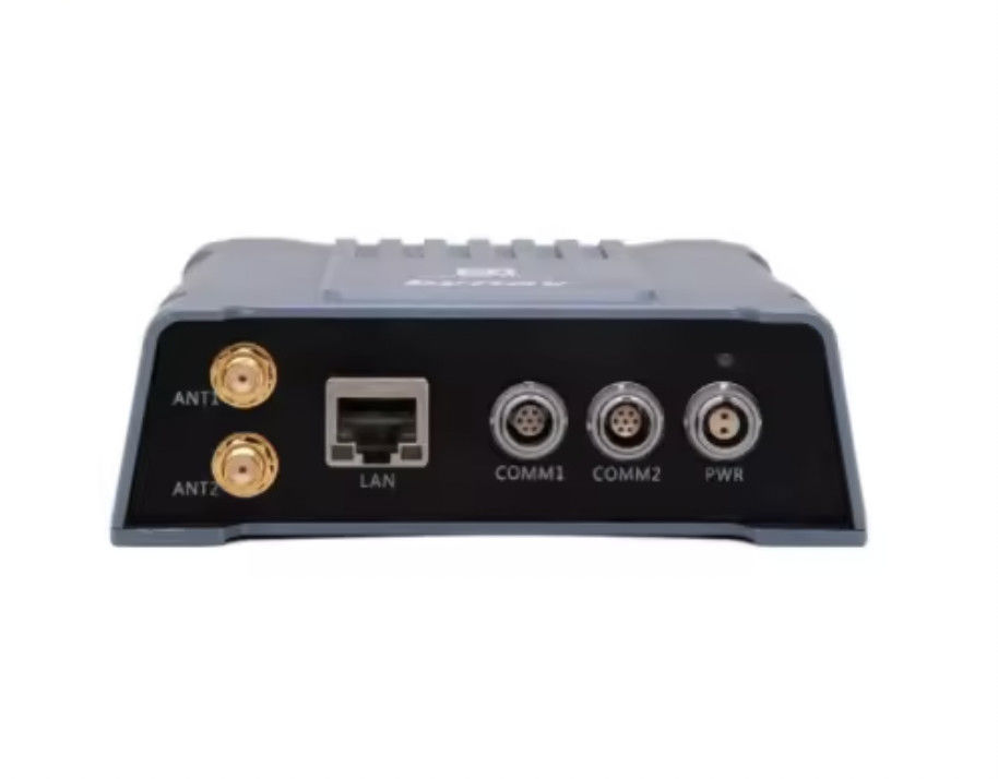
High Precision Surface Mount Navigation System with 10000 Hours MTBF
Product Details:
| Place of Origin: | China |
| Brand Name: | BTSTC |
| Certification: | CE |
| Model Number: | INS70S |
Payment & Shipping Terms:
| Minimum Order Quantity: | 1 |
|---|---|
| Price: | Negotiable |
| Packaging Details: | box and sponge |
| Delivery Time: | 7 days for sample |
| Payment Terms: | T/T |
| Supply Ability: | 1000/month |
|
Detail Information |
|||
| Mounting: | Surface Mount | Size: | Compact |
|---|---|---|---|
| Application: | Tactical Weapons | Initialization Time: | ≤1minute |
| Speed Accuracy: | <0.15m / S (RMS) | Mtbf: | 10000 Hours |
| Sensors: | Accelerometer, Gyroscope, Magnetometer | Accuracy: | 0.01 Degrees |
| Highlight: | surface mount navigation system,navigation system with 10000 hours mtbf,precision gps ins |
||
Product Description
Accuracy Surface Mount Navigation System with 10000 Hours MTBF
Product Description:
Introducing our state-of-the-art High Precision FOG Integrated Navigation System , designed to cater to the most demanding navigation requirements across various platforms. Our system is engineered to deliver exceptional position and speed accuracy, ensuring reliable performance in a multitude of applications, from maritime and aerial navigation to complex land-based operations.
At the core of our product lies the promise of unparalleled precision. With a position accuracy of 5m (RMS), the system ensures that users can trust the location data provided to make informed decisions promptly. This level of accuracy is vital for applications where every meter counts, such as geodesy, autonomous vehicle navigation, and precision agriculture.
Speed is another critical factor in navigation, and our system does not disappoint. It boasts a speed accuracy of less than 0.15m/s (RMS), providing the confidence needed for dynamic applications that require precise velocity measurements, such as surveying moving objects or managing fleets of high-speed vehicles.
Our High Precision FOG Integrated Navigation System is at the forefront of positioning technology, utilizing multi-constellation GNSS (Global Navigation Satellite System) for robust and consistent positioning. By harnessing the power of multiple satellite constellations, the system is able to mitigate the risks associated with reliance on a single GNSS, thereby increasing the reliability and availability of navigation data in challenging environments.
The system is designed with user convenience in mind, featuring a rechargeable battery that ensures continuous operation even in the absence of an external power source. This feature is particularly beneficial for applications that require extended periods of use or that operate in remote areas where power availability may be limited.
With an initialization time of less than or equal to 1 minute, the High Precision FOG Integrated Navigation System is ready for action almost immediately after power-up. This rapid readiness is crucial in time-sensitive situations, allowing users to quickly commence their tasks without lengthy delays. Whether it's emergency response, military operations, or any other scenario where time is of the essence, our system delivers the quick start needed.
The High Precision FOG Integrated Navigation System is not just about raw performance; it is also about resilience. The system is designed to withstand the rigors of operation in harsh environments, ensuring consistent delivery of accurate data even under adverse conditions. This makes it an ideal choice for applications that require navigation assistance in challenging terrains and unpredictable weather conditions.
In summary, our High Precision FOG Integrated Navigation System stands out as a leader in the field of integrated navigation solutions. Its superior position and speed accuracy, multi-constellation GNSS positioning, user-friendly power supply, and quick initialization time make it an indispensable tool for any application that demands the highest level of navigational precision and reliability. We are confident that our system will exceed your expectations and provide you with the navigational support you need to succeed.
Features:
- Product Name: Integrated Navigation System
- Weight: Less Than 1kg
- Size: Compact
- Positioning: Multi-constellation GNSS
- Mounting: Surface Mount
- Application: Tactical Weapons
- High Precision FOG Integrated Navigation System
- FOG Integrated Navigation System
- Integrated navigation system
Technical Parameters:
| Parameter | Description |
|---|---|
| Mounting | Surface Mount |
| Application | Tactical Weapons |
| Sensors | Accelerometer, Gyroscope, Magnetometer |
| Compatibility | Military And Commercial Applications |
| Speed Accuracy | <0.15m / s (RMS) |
| Power Supply | Rechargeable Battery |
| Accuracy | 0.01 Degrees |
| Mtbf | 10000 Hours |
| Weight | Less Than 1kg |
| Positioning | Multi-constellation GNSS |
Applications:
The BTSTC INS70S Integrated Navigation System, originating from China, is an advanced solution designed to cater to tactical weapons applications where precision and reliability are paramount. This system, certified by CE, is a perfect blend of modern technology encapsulated in a compact size, ensuring it can be easily integrated into a wide range of platforms. With a position accuracy of 5m (RMS), the INS70S stands out as a noteworthy addition to any tactical operation requiring high precision navigation.
One of the primary application occasions for the BTSTC INS70S is within the defense sector. The system is ideally suited for surface-mounted roles on tactical vehicles, unmanned systems, and artillery. The High Precision FOG (Fiber Optic Gyro) Integrated Navigation System ensures that users benefit from rapid initialization times of less than 1 minute, which is crucial in situations where time is of the essence and quick deployment is necessary.
The FOG Integrated Navigation System is also designed to withstand the rigors of various environmental conditions, bolstering its applicability in various field scenarios. For instance, the system can be used in aerial surveys, where consistent and reliable data is vital for accurate mapping and reconnaissance. The INS70S by BTSTC can provide consistent performance, thereby maximizing operational efficiency and effectiveness.
With a minimum order quantity of just one unit and negotiable pricing, the BTSTC INS70S is accessible to a range of clients, from small-scale operations to large defense contractors. The system is packaged with care using boxes and sponge materials to ensure it arrives in pristine condition. A sample can be delivered within 7 days, demonstrating the company's commitment to swift and efficient customer service.
Moreover, the payment terms are flexible with T/T, accommodating different customer preferences. The BTSTC INS70S also boasts an impressive supply ability of 1000 units per month, which is indicative of the brand's scalability and readiness to fulfill large orders. Such attributes make the BTSTC INS70S an ideal integrated navigation system for both experimental projects and full-scale deployment in tactical scenarios.
Customization:
Brand Name: BTSTC
Model Number: INS70S
Place of Origin: China
Certification: CE
Minimum Order Quantity: 1
Price: Negotiable
Packaging Details: box and sponge
Delivery Time: 7 days for sample
Payment Terms: T/T
Supply Ability: 1000/month
Attitude Angle Error: ≤2°
Sensors: Accelerometer, Gyroscope, Magnetometer
Power Supply: Rechargeable Battery
Application: Tactical Weapons
Mounting: Surface Mount
Discover the High Precision MEMS Integrated Navigation System from BTSTC, the INS70S model, designed for tactical weapon applications. This Cost-effective Integrated Navigation System is engineered with advanced sensors including an Accelerometer, Gyroscope, and Magnetometer, ensuring an Attitude Angle Error of ≤2°. With a robust CE certification and originating from China, our Integrated Navigation System is a reliable choice. The INS70S is ready for delivery within 7 days for samples and is available with flexible payment terms. Enhance your tactical capabilities with BTSTC's High Precision MEMS Integrated Navigation System.
Support and Services:
Our Integrated Navigation System is designed with precision and user-friendliness in mind. To ensure a seamless experience, we offer comprehensive technical support and services tailored to meet your needs. Our support includes real-time troubleshooting, regular firmware updates, and detailed documentation to help you navigate through the functionalities of the system. Additionally, we provide an online knowledge base filled with FAQs, how-to guides, and best practices to enhance your product usage. For complex issues, our dedicated team of experts is available to assist you through a structured problem-resolution process, ensuring minimal downtime and optimal system performance.
Packing and Shipping:
The Integrated Navigation System is meticulously packaged to ensure its integrity during shipping. Encased in a protective, anti-static bag, the system is then cushioned with high-density foam inserts that conform to its shape, providing shock absorption and preventing movement within the outer carton. The packaging materials are chosen for their durability and environmental sustainability.
Before sealing, we conduct a final inspection to guarantee that all components, including the main unit, power cables, and installation accessories, are securely packed. The outer carton is made from reinforced corrugated cardboard, offering additional strength for handling and transit. Each box is sealed with heavy-duty, tamper-evident tape and clearly labeled with handling instructions and the destination address.
We ship our Integrated Navigation Systems through trusted logistics partners with a proven track record for careful handling and prompt delivery. All shipments are tracked, and customers receive a shipping confirmation with a tracking number to monitor their package's journey. Our standard shipping option includes insurance coverage for the full value of the product, providing peace of mind and protection against unforeseen events.
Upon arrival, we advise customers to inspect the packaging for any signs of damage before accepting the delivery. If there are any concerns, it is important to note them with the delivery service and contact our customer support team for assistance. Our goal is to ensure that the Integrated Navigation System reaches you in perfect condition and ready for installation.
FAQ:
Q1: What is the brand name and model number of this Integrated Navigation System?
A1: The brand name of the Integrated Navigation System is BTSTC, and the model number is INS70S.
Q2: Where is the BTSTC INS70S Integrated Navigation System manufactured?
A2: The BTSTC INS70S Integrated Navigation System is manufactured in China.
Q3: Does the BTSTC INS70S come with any certification?
A3: Yes, the BTSTC INS70S Integrated Navigation System comes with CE certification.
Q4: What is the minimum order quantity for the BTSTC INS70S, and what are the payment terms?
A4: The minimum order quantity for the BTSTC INS70S is 1 unit, and the payment terms are T/T (Telegraphic Transfer).
Q5: What are the packaging details and delivery time for the BTSTC INS70S?
A5: The BTSTC INS70S is packaged in a box with sponge for protection, and the delivery time for a sample is 7 days.
Q6: What is the price of the BTSTC INS70S Integrated Navigation System?
A6: The price of the BTSTC INS70S Integrated Navigation System is negotiable.
Q7: What is the supply ability of the BTSTC INS70S per month?
A7: The supply ability for the BTSTC INS70S is 1000 units per month.


